Process: Mapping The Morris Isaacson High School Route
Date: 24 July 2006
Route guides: Mpafi Mpafi and Oupa Moloto
Facilitator: Ali Hlongwane
Documenter: Ismail Farouk
Early on the 24th of July 2006, a bitterly cold morning, our research group set off from the Hector Pieterson Museum and Memorial (HPMM) to retrace the main route from Morris Isaacson High School in Central Western Jabavu to Phefeni Senior Secondary School in Orlando West. Our objectives were to map the route and identify important landmarks and places of interest along the way.
Our beginning point was Jabulani Hostels in Moahloli Street at the point before the street becomes Mputhi Street. âÂÂJabulaniâ means happiness. However, Mpafi Mpafi reminded us that the history of Jabulani Hostel dwellers and their relationship with township residents was not always happy. Running battles between hostel inmates and township residents occurred here during 1976.
Factors contributing to the hostility between hostel dwellers and township residents include the use of hostel inmates as strike breakers during the stay-away of 23 -25 August 19761. The Soweto Students Representative Council (SSRC) called for mass stay-away protests between August and November 1976. Hostel dwellers ignored this stay-away call because of the intervention of the police, Inkatha and the Soweto Urban Bantu Council. This led to the harassment of hostel dwellers by township youth. Other factors included the nature of the hostel institution which created class separation from the rest of the township community1. Living conditions in hostels were squalid and inmates had no rights whatsoever. Hostels were made up of large halls with communal facilities. Common water taps, showers and toilets were provided outside hostels. The poor conditions within hostels encouraged anti-social behaviour.
From Jabulani Hostels it is possible to see the Oppenheimer Tower in the distance. We headed off towards the tower by first travelling north on Mputhi Street and then west, by turning left into Taelo Street. At the intersection of Mputhi and Taelo streets there was much paving activity, part of the JRA sidewalk paving project.
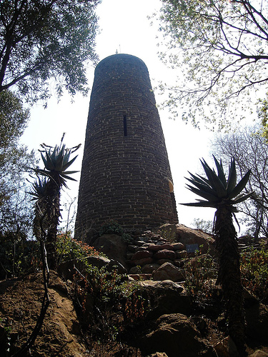
We reached Oppenheimer Tower complex which is set within parklike surroundings. The tower was built in 1955 from ash bricks which were the remains of shantytowns.
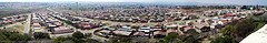
The view from the tower provides a sense of the vastness of Soweto. From here looking south, there is a great view of the train-like housing architecture of Jabulani Hostels. Further in the south-west, the West Rand Administration Board (WRAB) Fresh Fruit Market is visible. The WRAB Fresh Fruit Market was set alight and destroyed on June 16 1976. We were reminded of the violence of that dayâÂÂs events by Oupa Moloto recalling the gruesome sight of a headless boy lying on the ground with a cabbage under each arm.
Other landmarks visible from the tower include the 1976 memorial acre and the former home of Tsietsie Mashinini (see below), both of which are located close by in the suburb of Central Western Jabavu which surrounds the tower complex to the north and east. Still within the Oppenheimer gardens, we took a moment under the shadow cast by the Oppenheimer Tower where Mpafi Mpafi reminded us of the running battles between township residents and hostel dwellers which occurred in the park. He also pointed out that the gardens were a place of refuge for students who hid amongst the trees.
The Oppenheimer Tower is located adjacent to The Credo Mutwa Cultural Village. The village, also known as Khayalendaba, or "Place of Stories", has always been associated with story-telling, rituals and ceremonies, plays and other cultural activities. Its founder, Credo Mutwa is a Zulu Sangoma or traditional healer, a cultural historian and an award-winning nature conservationist in South Africa. Credo who is over 80 years old, is known worldwide as the Zulu Shaman. In 1976 students thought he was a collaborator and his house in Diepkloof was burnt down in the aftermath of June 16. Later most of the cultural village was destroyed too because of Credo MutwaâÂÂs testimony in the stateâÂÂs official enquiry into the student uprisings.
From the Credo Mutwa Village and Oppenheimer Tower complex we headed back to Mputhi Street and parked across from Morris Isaacson High School at the 1976 Memorial Acre, which is in the process of development. Mpafi remarked that it was students from Morris Isaacson High School who were central to the planning of the student march on June 16. One such student, Tsietsie Mashinini, lived across the road from Morris Isaacson High School.
Today, the family of Tsietsie Mashinini is trying to purchase the former family home with a view to converting it into a family museum in honour of the fallen hero. The 1976 Memorial Acre contains a newly erected monument in TsietsieâÂÂs honour. The monument was created as part of the Sunday Times Heritage Public Art programme. Its physical form resembles a giant book which symbolizes the crisis in education experienced in 1976. On the face of the book is the map of the route taken by the students from Morris Isaacson High School to Phefeni Junior Secondary in Orlando West, whilst the back cover of the âÂÂbookâ is inscribed with a tribute to Tsietsie Mashinini.
We continued up Mputhi Street past the killing site of Dr Melville Edelstein. Dr. Edelstein was one of two white officials beaten to death that day. A sociologist, Dr. Edelstein worked closely with many youth from Soweto. Earlier on the fateful morning, he greeted students as they past his house on Mputhi Street. However, once news of Hector Pieterson's death filtered through the ranks, happiness turned to anger and Dr. Edelstein was murdered for being a white man in the wrong place at the wrong time. Ironically, Dr Edelstein had warned that the hostility of township youth should be taken as a serious threat to peace in Soweto. In his thesis, written five years prior to the events of June 16, "What Young Africans Thinkâ (1971), 73 percent of the youth interviewed listed inadequate political rights among major grievances.
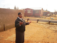
We briefly left the route in order to document two houses of historical significance. The first, belonging to Titi Mthenjana was known as âÂÂThe Headquartersâ or HQ. This house was a safe haven for students who would sleep here in order to escape harassment by the police. The second house also a safe haven for students belongs to Mr Mbatha, a student mentor and advisor. Mr MbathaâÂÂs home has changed considerably over time but Oupa Moloto still remembers how the home hosted important meetings of the SSRC.
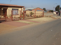
We returned to Mputhi Street and drove past Mshenguville Squatter camp, a former golf course. Further north on Mputhi Street, beyond the Roodeport intersection, the street name changes to Machaba Street. We turned right into Zulu Street and 200m ahead came to the site where Tsietsie Mashinini addressed crowds of students on the landmark bridge. The bridge is relatively unchanged since the 70s. Here Mashinini exhorted the students to remain calm and protest peacefully.
We continued towards Orlando West past the point where Machaba Street becomes Mahalafele Street, turned right into Phiri Street and left into Vilikazi Street. Our journey ended on Vilikazi Street at the intersection with Moema Street outside Phefeni Junior Secondary School. This is where students congregated on the morning of June 16 1976. Today this intersection has been memorialised by a monument marking the shooting site of Hector Pierterson. For many this is where the march ended as waiting police opened fire on protesting students.
Sources:
1. Moss, G. (1982): 'Crisis and Conflict: Soweto 1976-7', MA dissertation, University of the Witwatersrand.
Route guides: Mpafi Mpafi and Oupa Moloto
Facilitator: Ali Hlongwane
Documenter: Ismail Farouk
Early on the 24th of July 2006, a bitterly cold morning, our research group set off from the Hector Pieterson Museum and Memorial (HPMM) to retrace the main route from Morris Isaacson High School in Central Western Jabavu to Phefeni Senior Secondary School in Orlando West. Our objectives were to map the route and identify important landmarks and places of interest along the way.
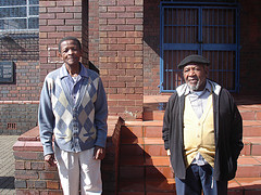
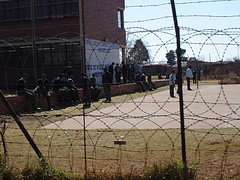
Our beginning point was Jabulani Hostels in Moahloli Street at the point before the street becomes Mputhi Street. âÂÂJabulaniâ means happiness. However, Mpafi Mpafi reminded us that the history of Jabulani Hostel dwellers and their relationship with township residents was not always happy. Running battles between hostel inmates and township residents occurred here during 1976.
Figure: The Research Group Standing Outside Jabulani Hostels
Factors contributing to the hostility between hostel dwellers and township residents include the use of hostel inmates as strike breakers during the stay-away of 23 -25 August 19761. The Soweto Students Representative Council (SSRC) called for mass stay-away protests between August and November 1976. Hostel dwellers ignored this stay-away call because of the intervention of the police, Inkatha and the Soweto Urban Bantu Council. This led to the harassment of hostel dwellers by township youth. Other factors included the nature of the hostel institution which created class separation from the rest of the township community1. Living conditions in hostels were squalid and inmates had no rights whatsoever. Hostels were made up of large halls with communal facilities. Common water taps, showers and toilets were provided outside hostels. The poor conditions within hostels encouraged anti-social behaviour.
From Jabulani Hostels it is possible to see the Oppenheimer Tower in the distance. We headed off towards the tower by first travelling north on Mputhi Street and then west, by turning left into Taelo Street. At the intersection of Mputhi and Taelo streets there was much paving activity, part of the JRA sidewalk paving project.
We reached Oppenheimer Tower complex which is set within parklike surroundings. The tower was built in 1955 from ash bricks which were the remains of shantytowns.
Figure: Oppenheimer Tower
The view from the tower provides a sense of the vastness of Soweto. From here looking south, there is a great view of the train-like housing architecture of Jabulani Hostels. Further in the south-west, the West Rand Administration Board (WRAB) Fresh Fruit Market is visible. The WRAB Fresh Fruit Market was set alight and destroyed on June 16 1976. We were reminded of the violence of that dayâÂÂs events by Oupa Moloto recalling the gruesome sight of a headless boy lying on the ground with a cabbage under each arm.
Figure: The vastness of Soweto from Oppenheimer Tower
Other landmarks visible from the tower include the 1976 memorial acre and the former home of Tsietsie Mashinini (see below), both of which are located close by in the suburb of Central Western Jabavu which surrounds the tower complex to the north and east. Still within the Oppenheimer gardens, we took a moment under the shadow cast by the Oppenheimer Tower where Mpafi Mpafi reminded us of the running battles between township residents and hostel dwellers which occurred in the park. He also pointed out that the gardens were a place of refuge for students who hid amongst the trees.
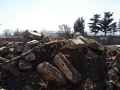
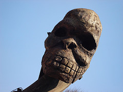
The Oppenheimer Tower is located adjacent to The Credo Mutwa Cultural Village. The village, also known as Khayalendaba, or "Place of Stories", has always been associated with story-telling, rituals and ceremonies, plays and other cultural activities. Its founder, Credo Mutwa is a Zulu Sangoma or traditional healer, a cultural historian and an award-winning nature conservationist in South Africa. Credo who is over 80 years old, is known worldwide as the Zulu Shaman. In 1976 students thought he was a collaborator and his house in Diepkloof was burnt down in the aftermath of June 16. Later most of the cultural village was destroyed too because of Credo MutwaâÂÂs testimony in the stateâÂÂs official enquiry into the student uprisings.
Figure: Mythological Sculpture at Credo Mutwa
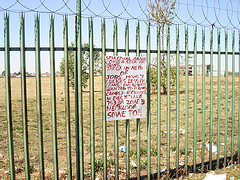
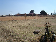
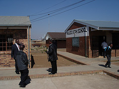
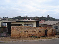
From the Credo Mutwa Village and Oppenheimer Tower complex we headed back to Mputhi Street and parked across from Morris Isaacson High School at the 1976 Memorial Acre, which is in the process of development. Mpafi remarked that it was students from Morris Isaacson High School who were central to the planning of the student march on June 16. One such student, Tsietsie Mashinini, lived across the road from Morris Isaacson High School.
Figure: The Home Of Tsietsie Mashinini
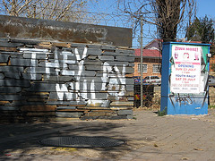
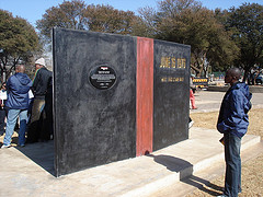
Today, the family of Tsietsie Mashinini is trying to purchase the former family home with a view to converting it into a family museum in honour of the fallen hero. The 1976 Memorial Acre contains a newly erected monument in TsietsieâÂÂs honour. The monument was created as part of the Sunday Times Heritage Public Art programme. Its physical form resembles a giant book which symbolizes the crisis in education experienced in 1976. On the face of the book is the map of the route taken by the students from Morris Isaacson High School to Phefeni Junior Secondary in Orlando West, whilst the back cover of the âÂÂbookâ is inscribed with a tribute to Tsietsie Mashinini.
Figure: Monument to Tsietsie Mashinini
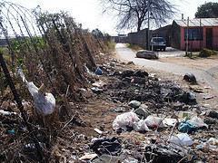
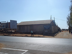
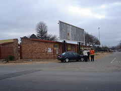
We continued up Mputhi Street past the killing site of Dr Melville Edelstein. Dr. Edelstein was one of two white officials beaten to death that day. A sociologist, Dr. Edelstein worked closely with many youth from Soweto. Earlier on the fateful morning, he greeted students as they past his house on Mputhi Street. However, once news of Hector Pieterson's death filtered through the ranks, happiness turned to anger and Dr. Edelstein was murdered for being a white man in the wrong place at the wrong time. Ironically, Dr Edelstein had warned that the hostility of township youth should be taken as a serious threat to peace in Soweto. In his thesis, written five years prior to the events of June 16, "What Young Africans Thinkâ (1971), 73 percent of the youth interviewed listed inadequate political rights among major grievances.
Figure: Dr. Melvillle Edelstein's body was found here on Mputhi Street.
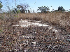
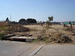
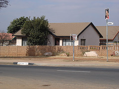
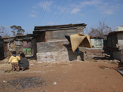
We briefly left the route in order to document two houses of historical significance. The first, belonging to Titi Mthenjana was known as âÂÂThe Headquartersâ or HQ. This house was a safe haven for students who would sleep here in order to escape harassment by the police. The second house also a safe haven for students belongs to Mr Mbatha, a student mentor and advisor. Mr MbathaâÂÂs home has changed considerably over time but Oupa Moloto still remembers how the home hosted important meetings of the SSRC.
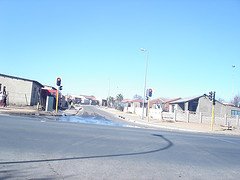
Figure: Mshenguville Informal Settlement
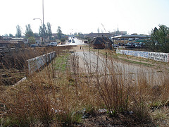
We returned to Mputhi Street and drove past Mshenguville Squatter camp, a former golf course. Further north on Mputhi Street, beyond the Roodeport intersection, the street name changes to Machaba Street. We turned right into Zulu Street and 200m ahead came to the site where Tsietsie Mashinini addressed crowds of students on the landmark bridge. The bridge is relatively unchanged since the 70s. Here Mashinini exhorted the students to remain calm and protest peacefully.
Figure: The Bridge where Tsietsie addressed students.
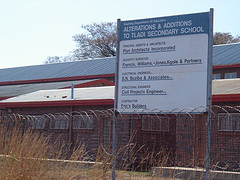
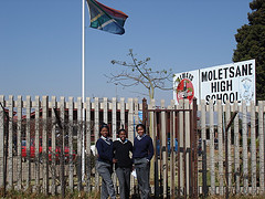
We continued towards Orlando West past the point where Machaba Street becomes Mahalafele Street, turned right into Phiri Street and left into Vilikazi Street. Our journey ended on Vilikazi Street at the intersection with Moema Street outside Phefeni Junior Secondary School. This is where students congregated on the morning of June 16 1976. Today this intersection has been memorialised by a monument marking the shooting site of Hector Pierterson. For many this is where the march ended as waiting police opened fire on protesting students.
Sources:
1. Moss, G. (1982): 'Crisis and Conflict: Soweto 1976-7', MA dissertation, University of the Witwatersrand.
Labels: Morris Isaacson High School, School Routes, The Routes